Route Asymmetry in Google Maps
I have been retrieving some route information using Rodrigo Azuero’s gmapsdistance package and noted that there was some asymmetry in the results: the time and distance for the trip from A to B was not necessarily always the same as the time and distance for the trip from B to A. Although in retrospect this seems self-evident, it merited further investigation.
Let’s consider two locations in my old neighbourhood:
- 115 St Andrew’s Drive, Durban North, 4051, South Africa — A and
- 25 Gainsborough Drive, Athlone, Durban North, 4051, South Africa — B.
To use those locations as the origin and destination arguments for gmapsdistance() we’ll first need to do some minor encoding, replacing spaces with +.
> A = gsub(" ", "+", "115 St Andrew's Drive, Durban North, 4051, South Africa")
> B = gsub(" ", "+", "25 Gainsborough Drive, Athlone, Durban North, 4051, South Africa")
For reproducibility we’ll stipulate a specific date and time (this only has any effect if you’ve provided a Google Maps API key, otherwise it will be silently ignored).
> DEPARTURE = as.integer(as.POSIXct("2017-08-23 18:00:00"))Now we can calculate the distances and times for trips in either direction. First look at the trip from A to B.
> library(gmapsdistance)
> gmapsdistance(A, B, departure = DEPARTURE, mode = "driving")
$Time
[1] 405

$Distance
[1] 2931

$Status
[1] "OK"
Then the trip in the opposite direction, from B to A.
> gmapsdistance(B, A, departure = DEPARTURE, mode = "driving")
$Time
[1] 412

$Distance
[1] 2931

$Status
[1] "OK"
We see that the distance in both cases is the same (which stands to reason if the same route was taken in both directions) but that the times are different: 6:45 (405 seconds) from A to B and 6:52 (412 seconds) from B to A.
The difference is more pronounced if we consider different levels of congestion by using the traffic_model argument. In an optimistic scenario the travel times in both directions are shorter but the disparity increases from 7 seconds to 17 seconds. Under pessimistic conditions both trips become slower and the difference extends to 20 seconds.
traffic_model
|
A → B | B → A | Δ |
|---|---|---|---|
best_guess
|
405 | 412 | 7 |
optimistic
|
341 | 358 | 17 |
pessimistic
|
489 | 509 | 20 |
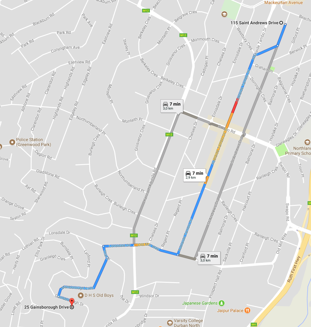
To gain further insight into these results I took a look at the routes considered by Google Maps. For the trip from A to B the recommended route passes through some congested areas but looks good for the most part.
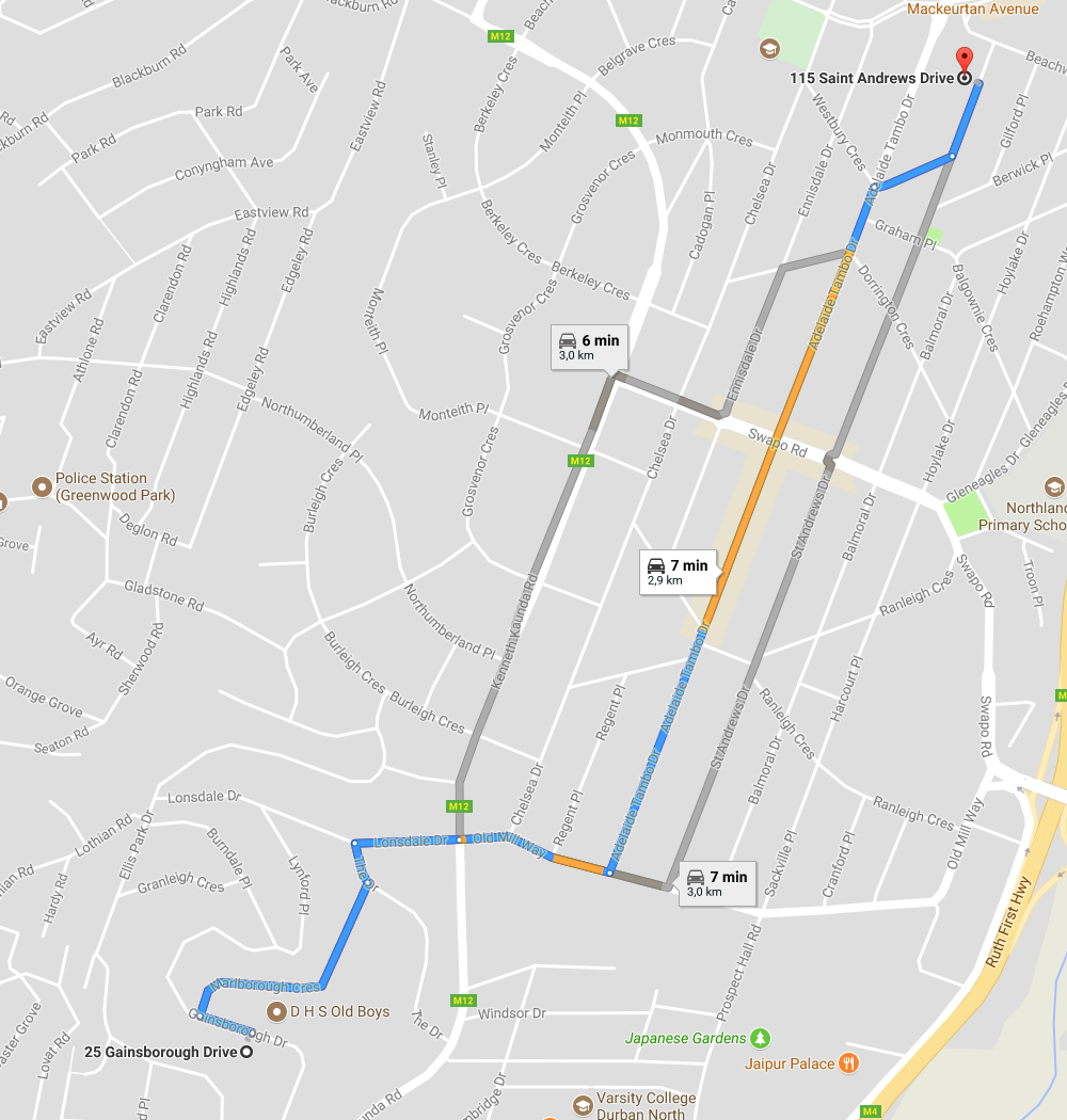
The recommended course from B to A travels along the same route in reverse, but now we see that there are more extended congested segments. This would account for the slightly longer travel time.
This exercise has given me a lot of confidence in the result returned by gmapsdistance and confirmed my previous thinking about Google Maps: damn clever technology!