I’ve just added some more data to the {blimey} package:
- postal codes and
- postbox locations.
Data Sources
The postal code data was acquired from gov.uk as a collection of CSV files. The data were read and consolidated into a single data frame. The coordinates were transformed from CRS 27700 (British National Grid) to CRS 4326 (World Geodetic System).
The postbox locations were retrieved from https://postboxes.dracos.co.uk/, an awesome interactive map created by Matthew Somerville using data from the Royal Mail. The data were lightly cleaned (there’s still some work to be done though).
Load the Package
If you haven’t installed the package, then grab it from GitHub.
devtools::install_github("datawookie/blimey")
Load the package.
library(blimey)
Postal Codes
First let’s look at the postal code data.
postal
# A tibble: 1,728,243 × 4
   postcode   lat   lon country_iso
   <chr>    <dbl> <dbl> <chr>
 1 AB10 1AB  57.1 -2.10 SCT
 2 AB10 1AF  57.1 -2.10 SCT
 3 AB10 1AG  57.1 -2.10 SCT
 4 AB10 1AH  57.1 -2.10 SCT
 5 AB10 1AL  57.2 -2.10 SCT
 6 AB10 1AN  57.1 -2.09 SCT
 7 AB10 1AP  57.1 -2.10 SCT
 8 AB10 1AQ  57.1 -2.09 SCT
 9 AB10 1AR  57.1 -2.10 SCT
10 AB10 1AS  57.1 -2.10 SCT
# … with 1,728,233 more rows
# ℹ Use `print(n = ...)` to see more rows
The data covers England, Scotland and Wales.
postal %>% pull(country_iso) %>% unique() %>% sort()
[1] "ENG" "SCT" "WLS"
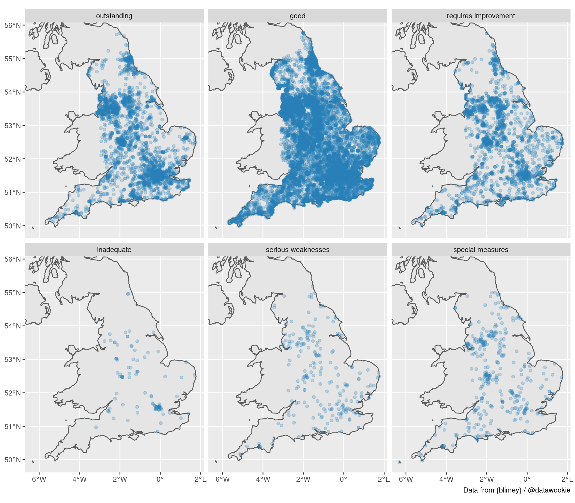
It would be really useful to have the polygons for the postal code boundaries. However, for the moment there’s only a single coordinate. This should still be useful for a variety of applications. For example, smashing together the schools and postal data allows us to plot the locations of schools broken down by their Ofsted rating.

Postboxes
Now let’s take a look at postboxes.
nrow(postboxes)
[1] 115905
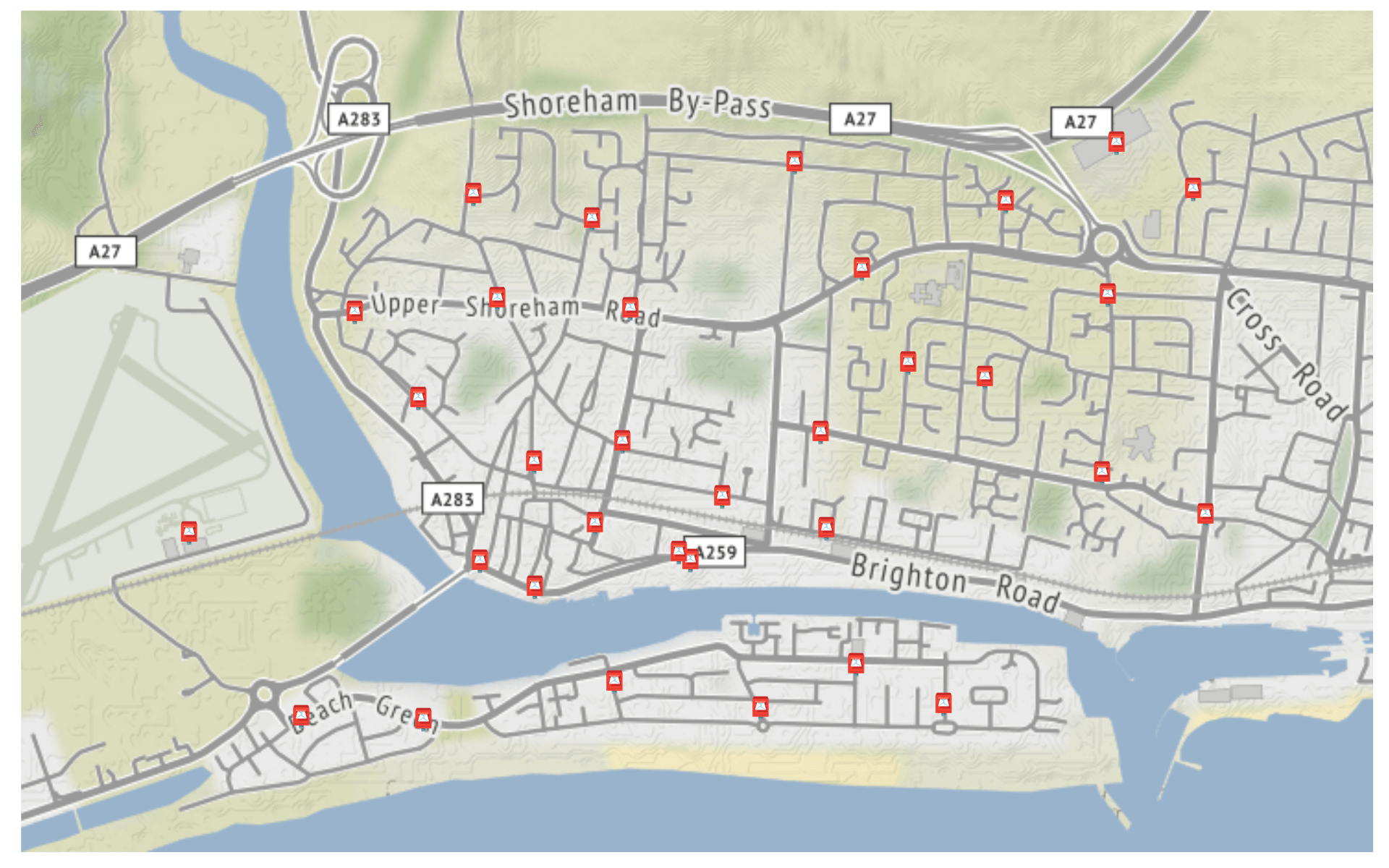
There are a lot of postboxes in the United Kingdom! We’ll narrow our attention to Shoreham-by-Sea, a little seaside town in West Sussex.
# A tibble: 33 × 5
   postbox_code name                     lat    lon last_collection
   <chr>        <chr>                  <dbl>  <dbl> <chr>
 1 BN43 1533    The Burrells            50.8 -0.257 Mo-Fr 09:00; Sa 07:00
 2 BN43 1534    Shingle Road            50.8 -0.265 Mo-Fr 09:00; Sa 07:00
 3 BN43 1532    Winterton Way           50.8 -0.261 Mo-Fr 09:00; Sa 07:00
 4 BN43 1535    East Beach Post Office  50.8 -0.272 Mo-Fr 17:00; Sa 12:15
 5 BN43 1536    Beach Green             50.8 -0.281 Mo-Fr 09:00; Sa 07:00
 6 BN43 1511    Kingston Lane           50.8 -0.245 Mo-Fr 09:00, Sa 07:00
 7 BN43 1529    Dolphin Road            50.8 -0.262 Mo-Fr 18:15; Sa 12:30
 8 BN43 1543    Riverside Business Box  50.8 -0.268 Mo-Fr 18:30
 9 BN43 1540    Surrey Street           50.8 -0.269 Mo-Fr 18:00; Sa 11:45
10 BN43 1512    St Julians              50.8 -0.249 Mo-Fr 17:00; Sa 11:45
# … with 23 more rows
# ℹ Use `print(n = ...)` to see more rows
There are two additional fields, postal_code and address. Using these data we can immediately plot out the locations of the postboxes.

Fun Challenge
A fun challenge would be to transform the last_collection field in the postboxes data into wide format, with one column per day of week.