I’ve just added data on schools in England to the {blimey} package. The raw data were obtained from gov.uk.
Load the Package
If you haven’t installed the package, then grab it from GitHub.
devtools::install_github("datawookie/blimey")Load the package.
library(blimey)Schools Data
The schools data are in the schools package variable. Let’s take a look at the first few records and pick out some interesting fields.
schools %>% head() %>% select(school_id, school_name, age_min, age_max, gender, rating)# A tibble: 6 × 6
school_id school_name age_min age_max gender rating
<dbl> <chr> <int> <int> <fct> <ord>
1 100000 The Aldgate School 3 11 mixed outstanding
2 100001 City of London School for Girls 7 18 girls <NA>
3 100002 St Paul's Cathedral School 4 13 mixed <NA>
4 100003 City of London School 10 18 boys <NA>
5 100008 Argyle Primary School 3 11 mixed good
6 100009 West Hampstead Primary School 3 11 mixed good School Locations
The spatial distribution of schools can be examined by looking at the postal code and linking to local authorities.
schools %>%
  inner_join(local_authority) %>%
  select(school_name, local_authority_name, postcode)
# A tibble: 26,166 × 3
school_name local_authority_name postcode
<chr> <chr> <chr>
1 The Aldgate School City of London EC3A 5DE
2 City of London School for Girls City of London EC2Y 8BB
3 St Paul's Cathedral School City of London EC4M 9AD
4 City of London School City of London EC4V 3AL
5 Argyle Primary School Camden WC1H 9EG
6 West Hampstead Primary School Camden NW6 1QL
7 Brecknock Primary School Camden NW1 9AL
8 Brookfield Primary School Camden N19 5DH
9 Carlton Primary School Camden NW5 4AX
10 Edith Neville Primary School Camden NW1 1DN
# … with 26,156 more rows
# ℹ Use `print(n = ...)` to see more rowsRating Distribution
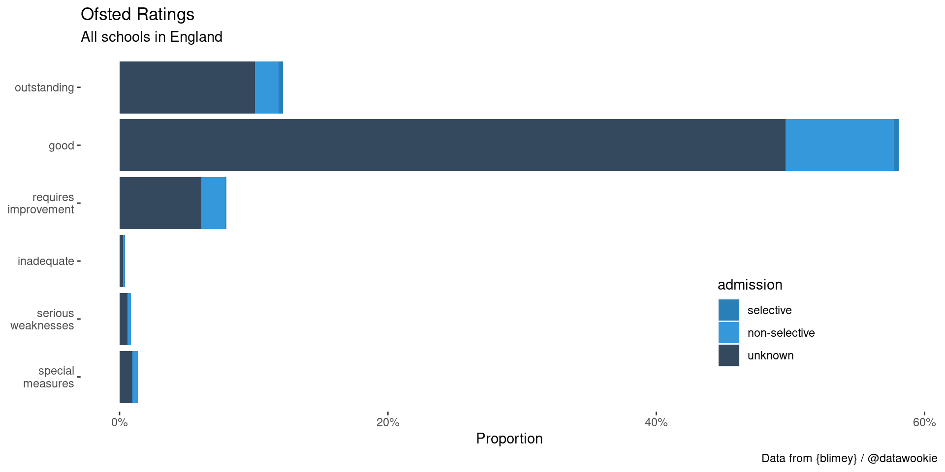
Oftsed ratings are a somewhat contentious system for grading schools. Looking at the distribution of ratings, it appears that the majority of schools are rated as Good.
Viewing the spatial distribution of these data would probably be rather interesting. Next steps for {blimey} will include information on postal codes, which should make this possible.